Ohio Braces for Mixed Rain, Snow and Ice Thursday Night Into Day
Updated (2 articles)
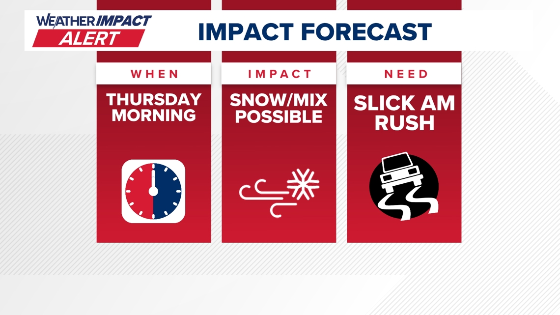
Statewide Weather Impact Alert Issued for Thursday Storm The 10 Weather Impact team released a Level 10 alert Thursday, warning that a storm system will bring rain, snow and ice across Ohio from Wednesday night through Thursday daytime, with chief meteorologist Chris Tomer leading updates [1].
Forecast Models Disagree on Rain‑Snow Distribution Computer projections diverge: some models push the system farther north, delivering primarily rain to central and southern Ohio, while others forecast a heavier wintry mix of snow and ice in the same region, leaving exact accumulation amounts uncertain [1].
Travel Risks Highlighted as Wintry Mix Approaches Officials caution that the combination of precipitation types could create slippery roads and hazardous travel conditions, urging drivers to stay alert, reduce speed, and monitor real‑time alerts [1].
Continuous Updates Provided via Online Forecast Page The team will post ongoing information on the 10 Weather Impact Forecast page, and meteorologists will share real‑time alerts through social‑media channels to keep the public informed [1].
Related Tickers
Timeline
Dec 9, 2025 – The 10 TV Weather Impact team issues a Weather Impact Alert Day for Wednesday as a strong Midwest storm moves into central Ohio, bringing a rain‑snow mix in the morning, minimal snow accumulation due to near‑freezing temperatures, and wind gusts up to 40 mph that threaten slippery roads and low visibility [2].
Dec 9, 2025 – Forecasters note a weaker system will quickly build Friday into Saturday, with the potential to produce light snow across the region [2].
Feb 23, 2026 – The 10 Weather Impact team releases a 10 Weather Impact Alert for Thursday, warning that the approaching storm system could deliver rain, snow and ice throughout Ohio [1].
Feb 23, 2026 – Computer models diverge on the storm’s rain‑versus‑snow distribution: some push the system farther north for more rain in central and southern Ohio, while others forecast greater snow and ice in the same area [1].
Feb 23, 2026 – Officials project the storm’s impact window from Wednesday night through Thursday daytime, stating “the combination of rain, snow and ice may make travel dangerous, urging drivers to stay alert and monitor updates” [1].
Feb 23, 2026 – The 10 Weather Impact team pledges continuous updates on its Forecast page, with chief meteorologist Chris Tomer and staff providing real‑time alerts on social media, noting “team will continue updates; forecasts and meteorologists available online” [1].
All related articles (2 articles)
External resources (4 links)
- https://www.facebook.com/AaronWhiteTV/ (cited 1 times)
- https://www.facebook.com/ChrisTomer (cited 1 times)
- https://www.facebook.com/GarofaloWX (cited 1 times)
- https://www.facebook.com/mikebehrenswx (cited 1 times)