Strong Thursday Storms Threaten Central Ohio With Wind, Hail, Possible Tornado
Updated (2 articles)
Warm Temperatures Set Stage for Thursday’s Storms Wednesday’s showers gave way to a surge of warm air that lifted temperatures into the 60 °F range across central Ohio, and those temperatures are expected to linger into Thursday, creating a moist environment for storms [1].
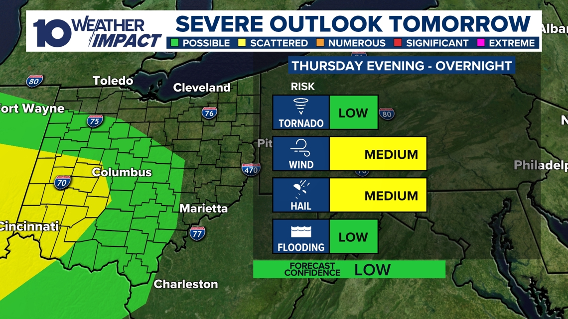
Cold Front Arrival Triggers Marginal Severe‑Weather Risk A fast‑moving cold front is forecast to hit Thursday, prompting a Level‑1 of 5 marginal risk driven by a nearby low‑pressure system, an advancing warm front, and notable wind shear; wind and hail are the primary threats, while an isolated tornado cannot be ruled out [1].
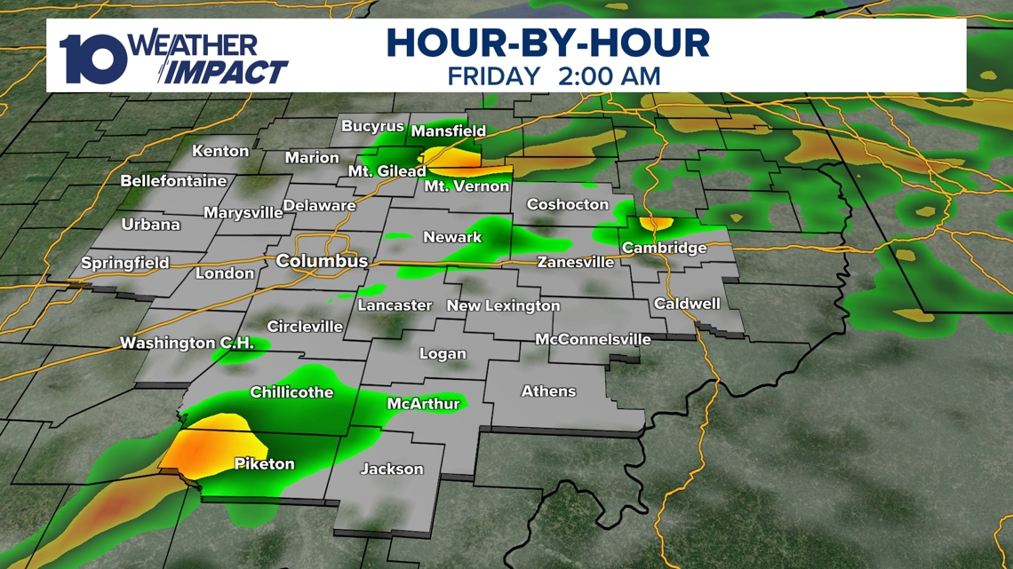
Storms Peak Early Afternoon, Then Weaken The strongest thunderstorms are projected to develop in the early afternoon when daylight and atmospheric energy are greatest, with intensity tapering through the evening and diminishing overnight; heavy rain could occur but major flooding is not anticipated [1].
After‑effects Include Gusty Friday Weather and Possible Sunday Snow Residents should expect continued gusty conditions into Friday as temperatures fall toward the weekend, and meteorologists note that snow showers could return as early as Sunday [1].
Related Tickers
Timeline
Dec 27 – 28, 2025 – A developing storm system moves into central Ohio late Sunday night and early Monday, bringing rain and thunderstorms statewide while warm southerly winds lift temperatures into the 60 °F range. [2]
Dec 28, 2025 – The Storm Prediction Center places portions of Ohio in a Level 1 severe‑weather risk, forecasting damaging wind gusts near 60 mph and noting that an isolated tornado cannot be ruled out. [2]
Dec 28 – 29, 2025 – A strong cold front clears the rain and storms, then ushers in much colder air, causing temperatures to plunge from the lower 60s at midnight to the 20s by Monday noon – a roughly 40 °F drop in 12 hours. [2]
Dec 29, 2025 – The rapid temperature fall creates a flash‑freeze risk, with wet roads expected to refreeze and produce slippery conditions throughout Monday morning and afternoon. [2]
Dec 29, 2025 – Snow showers are possible north and west of Ohio as a winter storm moves through the Upper Midwest, but most snowfall is forecast to remain well outside central Ohio. [2]
Feb 18, 2026 – Morning rain showers on Wednesday push temperatures across central Ohio into the 60 °F range, setting the stage for the next day’s severe‑weather threat. [1]
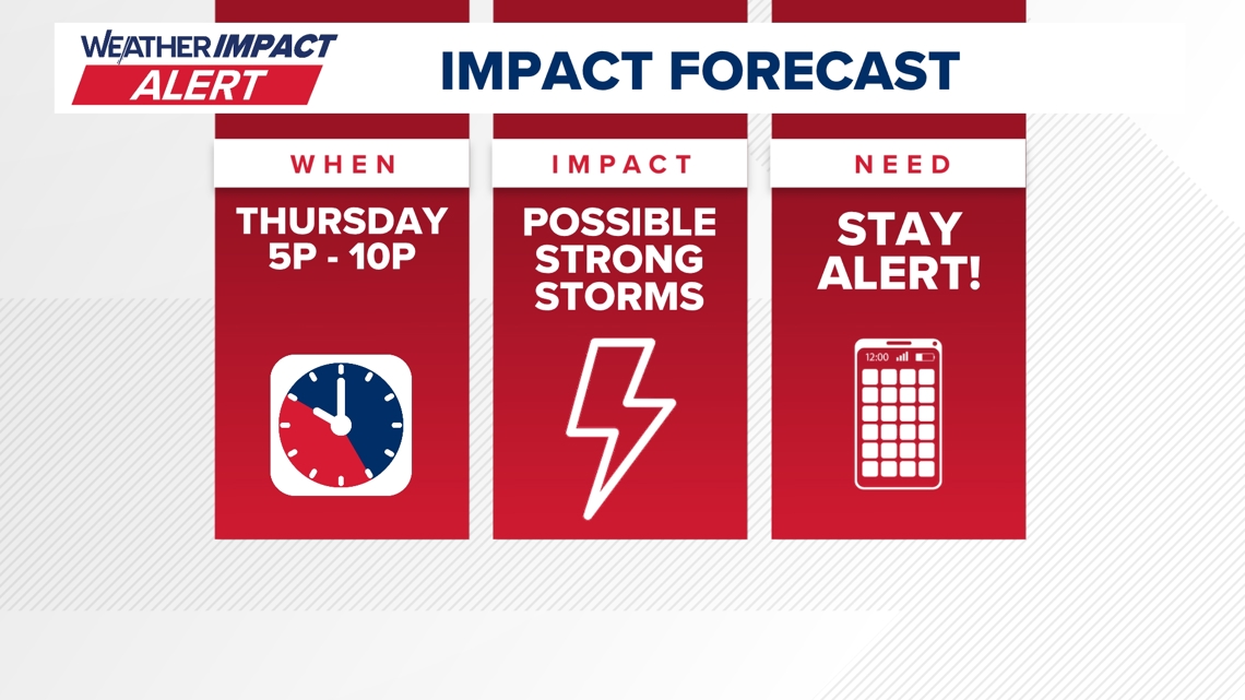
Feb 19, 2026 – A fast‑moving cold front arrives Thursday, prompting the issuance of a 10TV Weather Impact Alert for the afternoon and evening as strong to severe thunderstorms develop. [1]
Feb 19, 2026 – Atmospheric conditions produce a marginal Level‑1 severe‑weather risk, with wind shear driving threats of strong wind, large hail and a possible isolated tornado. [1]
Feb 19, 2026 – Storms peak early in the afternoon when energy and daylight are greatest, then weaken through the evening; heavy rain is possible but major flooding is not anticipated. [1]
Feb 20, 2026 – Gusty conditions persist into Friday as temperatures begin to fall toward the weekend, increasing the likelihood of strong wind gusts. [1]
Feb 22, 2026 – Snow showers could return as early as Sunday, marking the first chance of wintry precipitation after the warm spell. [1]
All related articles (2 articles)
External resources (3 links)
- http://facebook.com/MikeBehrensWX (cited 1 times)
- http://instagram.com/MikeBehrensWX (cited 1 times)
- http://twitter.com/MikeBehrensWX (cited 1 times)