Lowland Snow Bursts Across Western Washington Prompt School Delays and Light Slush on Feb 19
Updated (3 articles)
Snow Bursts Reach Low Elevations Across Counties Spotty snow fell Wednesday evening into Thursday in Snohomish, King and Pierce counties, with Bothell (≈300 ft) and Maltby (≈400 ft) receiving measurable flakes as a weak convergence zone lingered overhead [1]. Earlier on Wednesday, isolated snow also appeared in Marysville, Lake Stevens and parts of the Olympic Peninsula, while Tuesday’s wet snow touched Mason County and Kent [1]. Meteorologists note that snow levels have hovered between 500 ft and 1,000 ft this week, a range that matches the forecast issued two days earlier [2].
School District Adjusts Schedule Due to Snow The Granite Falls School District operated on a two‑hour delay on Thursday and cancelled classes on Wednesday in response to the snowfall [1]. District officials cited safety concerns on slushy roadways and the need to clear school‑site driveways before students arrived [1]. No other districts in the region reported closures, indicating the impact remained localized.
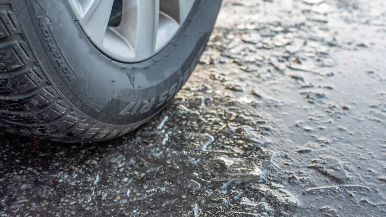
Accumulation Remains Light, Roads Mostly Slush Accumulations are expected to stay minimal, with most roadways remaining above freezing and only grassy or elevated surfaces collecting trace amounts [1]. Drivers encountered primarily slush rather than significant snow, reducing the likelihood of prolonged traffic snarls [1]. The limited buildup aligns with forecasts that heavier showers could temporarily lower snow levels but would not produce deep snowpacks [2].
Snow Levels Expected to Remain Low Through Friday Forecasters project snow levels to stay between 500 ft and 1,000 ft through Friday, after which Arctic air will lift the snow line to roughly 1,500 ft by Saturday [1][2]. This rise will curtail further low‑land snow chances, confining any additional accumulation to higher terrain [2]. Mountain areas are still slated to receive 6‑12 inches of snow by week’s end [2].
Potential Hazards From Freeze‑Thaw Cycles When precipitation pauses and temperatures dip below freezing, brief periods of ice can form on cleared road sections, creating slick conditions for motorists [2]. The combination of rain‑snow mix and intermittent freezing is expected to produce localized black‑ice patches, especially on bridges and shaded stretches [2]. Authorities advise drivers to reduce speed and allow extra stopping distance during these intervals.
Sources
-
1.
King5: Spotty Lowland Snow Hits Snohomish, King, and Pierce Counties: reports Feb 19 snow bursts at low elevations, school delays, minimal accumulation, and forecasts snow staying between 500‑1,000 ft through Friday .
-
2.
King5: Lowland Snow Possible Wednesday as Western Washington Precipitation Increases: outlines Feb 17 forecast of snow levels dropping to ~500 ft, rain‑snow mix, slick‑road hazards, mountain snow totals, and Arctic air raising snow levels to ~1,500 ft by Saturday .
Related Tickers
Timeline
Jan 7, 2026 – A colder system moves across western Washington, dropping snow levels from ~1,500 ft during the day to near 500 ft overnight, creating a brief chance of wet snow at sea level Thursday morning with little accumulation, while the Cascades stay under a Winter Storm Warning that could add 2–4 ft of snow and at least one foot at mountain passes; forecasters warn the main lowland concern is slick roads rather than significant snowfall [3].
Jan 26, 2026 – The region experiences its first 5:01 p.m. sunset of the year, marking a seasonal shift toward longer daylight that may affect future snow‑melt timing and travel conditions [3].
Feb 17, 2026 – Meteorologists issue a low‑land snow outlook for the upcoming Wednesday, with snow levels expected to dip to about 500 ft and a rain‑snow mix possible from the Kitsap Peninsula to coastal foothills; Rich Marriott notes “sleet or light snow” could occur, while Parella Lewis stresses that “overall effect on lowland communities should remain limited” despite potential slick spots between precipitation breaks [2].
Feb 19, 2026 – Spotty lowland snow bursts across Snohomish, King and Pierce counties, reaching Bothell at 300 ft and Maltby at 400 ft; Granite Falls schools operate on a two‑hour delay and cancel Wednesday classes, yet accumulations stay minimal and roads remain mostly slush, with snow levels projected to stay between 500‑1,000 ft through Friday [1].
Feb 22, 2026 – Forecasts indicate lingering Arctic air will raise snow levels to roughly 1,500 ft by Saturday, reducing the likelihood of further lowland snow while still supporting mountain snowfall accumulation [2].
Feb 23, 2026 (by week’s end) – Mountain regions are expected to have added 6–12 inches of snow by the end of the week, bolstering the regional snowpack despite tapering lowland impacts [2].
All related articles (3 articles)
-
King5 (Seattle, WA): Spotty Lowland Snow Hits Snohomish, King, and Pierce Counties
-
King5 (Seattle, WA): Lowland Snow Possible Wednesday as Western Washington Precipitation Increases
-
King5 (Seattle, WA): Snow levels fall overnight across western Washington, raising chance of lowland wet snow and slick roads