Red Flood Alerts Extended in Western France as Rivers Remain High, Relief Delayed
Updated (3 articles)
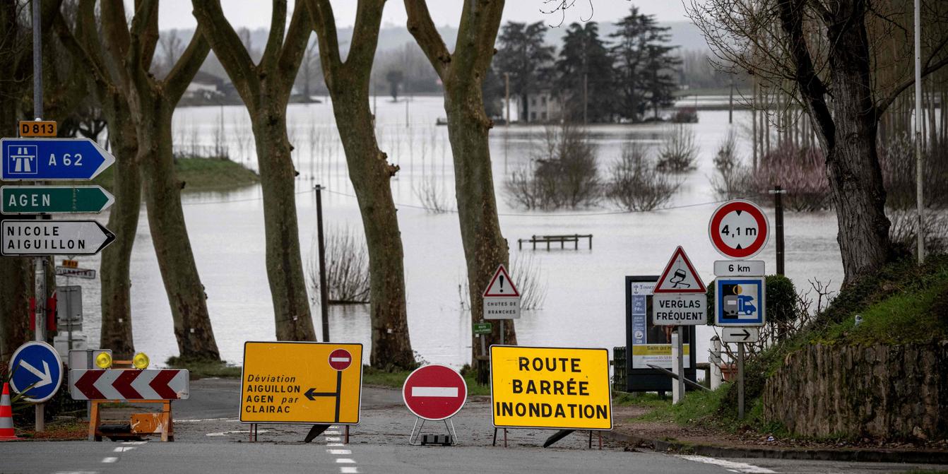
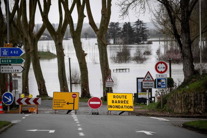
Red Alerts Prolonged Across Three Departments Météo‑France extended red flood vigilance for Loire‑Atlantique, Charente‑Maritime and Maine‑et‑Loire on 21‑22 Feb 2026, while nine adjacent departments remain at orange level; the agency noted that upcoming dry weather should help river recession later in the week[1].
River Levels Remain Very High, Stabilization Expected The national Vigicrues service forecasts that water levels will stay very high in the Saintes area and begin to stabilize overnight in Maine‑et‑Loire, with dry conditions expected to promote downstream declines but still cause rises in lower reaches[1].
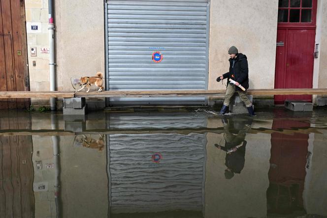
Angers Experiences Worst Flood Since 1995 Angers, home to 160 000 people, reports continuous river rise affecting at least 5 000 residents, marking the worst flood since 1995; road closures, tram disruptions and the full closure of the Verdun bridge have been imposed, while authorities install wooden planks and concrete blocks for pedestrian access[1].
Military Trucks Deployed to Preserve Mobility in Charente‑Maritime In Courcoury, three all‑terrain military vehicles replaced a broken tractor, each capable of carrying up to ten passengers to maintain commuting, schooling and medical trips, as explained by departmental prefect Brice Blondel[1].
Second Crisis‑Management Phase Planned for Late Next Week After the immediate “crisis management” stage, officials will launch a longer‑term support phase late next week to assist victims, address insurance issues and mitigate psychological impacts, according to the prefect’s outline[1].
Related Tickers
Timeline
Feb 5, 2026 – Morbihan enters an orange rain‑flood alert at noon, with meteorologists forecasting 15‑30 mm of rain that could reach 40 mm by night, while the Gironde department maintains its orange flood vigilance through Friday and Vigicrues warns of moderate to significant overflows in Bordeaux and Libourne as saturated catchments amplify runoff [3].
Feb 6, 2026 – Météo‑France raises orange vigilance for wave‑submersion in Alpes‑Maritimes and Corse‑du‑Sud at 06:00, adds orange flood alerts for Finistère and Gironde, and notes that record‑close January rainfall in Finistère and Morbihan pushes several communes to all‑time highs, increasing the risk of localized overflows especially in Quimperlé as high‑tide coefficients combine with strengthening winds that raise sea level near Solenzara [2].
Feb 21, 2026 – Red flood alerts extend through the weekend for Loire‑Atlantique, Charente‑Maritime and Maine‑et‑Loire, while Vigicrues expects river levels to stay very high and only stabilize overnight; Angers experiences a rising Maine River described as “the worst flood since 1995,” affecting 5 000 residents, closing the Verdun bridge and disrupting trams, and the prefecture deploys three all‑terrain military trucks in Charente‑Maritime to keep schools and medical trips running [1].
Feb 21, 2026 – In Saintes, about 1 380 homes remain flooded, 10 km of wooden planks provide pedestrian passage, and high‑tide coefficients continue to slow river outflow, prompting authorities to plan a second, longer‑term crisis‑management phase beginning late next week to support victims, address insurance claims and mitigate psychological impacts [1].
Feb 21, 2026 – The agency notes that upcoming dry weather should aid river recession downstream, though lower reaches may still rise, highlighting the delicate balance between precipitation, tidal forces and flood‑mitigation efforts across western France [1].
All related articles (3 articles)
External resources (3 links)
- https://vigilance.meteofrance.fr/fr (cited 1 times)
- https://vigilance.meteofrance.fr/fr/demain (cited 1 times)
- https://www.vigicrues.gouv.fr/bulletin_national (cited 1 times)