Central Ohio Schools Close Friday as Arctic Cold Threatens Record Low Temperatures
Updated (4 articles)
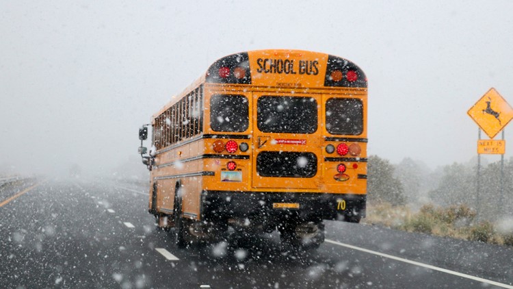
Widespread School Closures Continue Through Week Friday, Jan. 29, sees a wave of closures across central Ohio, including Columbus City, Whitehall, Groveport‑Madison, Lancaster, Canal Winchester, Pickerington, Delaware, Olentangy, Worthington, Hilliard, Dublin, and Westerville districts [1]. Earlier in the week, Monday, Tuesday, and Wednesday closures were announced for the same and additional districts such as Bexley, Gahanna‑Jefferson, Marysville, New Albany‑Plain, Reynoldsburg, South‑Western, Upper Arlington, and others [2][3][4]. The 10TV “Is school closed tomorrow?” page consolidates the evolving list for parents and staff.
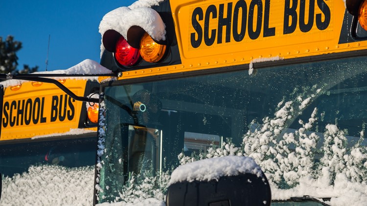
Arctic Air Drives Subzero Temperatures and Wind Chills A deep‑freeze Arctic mass brings morning lows near 0°F on Friday, with wind chills projected to stay at or below zero all day [1]. Forecasts predict Saturday could tie the Jan. 31 record low of –6°F, while wind chills may plunge to –20°F [1]. Throughout the week, subzero wind chills between –10°F and –20°F are expected, prompting continuous Weather Impact alerts [2][3][4]. Residents are urged to limit outdoor exposure due to frostbite risk.
Snowfall Accumulations Reach Up to 16 Inches The storm that arrived over the weekend deposited 8‑16+ inches of snow across the region, with some locales reporting over 16 inches, marking the season’s biggest event and the fifth‑largest on record for Columbus [4]. Snow depths contributed to the cascade of school closures and delayed openings [2][3]. Light snow showers may return mid‑week, but significant additional accumulation is not anticipated.
10TV Provides Alerts and Real‑Time Weather Tools Every morning from Wednesday through Sunday, 10TV issued Weather Impact alerts highlighting hazardous wind chills and cold‑related health risks [2]. The station’s website and mobile app offer interactive radar, watches, warnings, a 10‑day forecast, and push notifications to keep residents updated [1][3][4]. The “Is school closed tomorrow?” page is refreshed continuously as districts announce changes.
Sources
-
1.
WBNS (Columbus, OH): Central Ohio Schools Shut Down Friday Amid Arctic Cold: Details Friday’s extensive school closures, subzero wind chills, potential –6°F record low Saturday, and 10TV’s weather tools .
-
2.
WBNS (Columbus, OH): Central Ohio School Districts Close Wednesday Amid Deep Freeze: Lists Wednesday closures, 8‑16+ inches snowfall, week‑long sub‑20°F wind chills, and daily Weather Impact alerts .
-
3.
WBNS (Columbus, OH): Central Ohio School Districts Close Tuesday Amid Heavy Snow and Arctic Cold: Reports Tuesday closures, 8‑16 inches snow, –20°F wind chills, and ongoing alerts through the week .
-
4.
WBNS (Columbus, OH): Central Ohio schools close Monday as historic snowstorm brings extreme cold: Highlights Monday closures, over 16 inches snowfall—the season’s biggest event—and subzero wind chills persisting through the week .
Timeline
Jan 25, 2026 – Central Ohio districts announce Monday closures as a historic winter storm drops over 16 inches of snow, “the biggest of the season and the fifth‑largest on record for Columbus,” prompting subzero temperatures and wind chills of –10 °F to –20 °F and a statewide Weather Impact Alert for the next seven days [4].
Jan 26, 2026 – Multiple districts close schools Tuesday after the storm leaves 8‑16 inches of snow across the region and Arctic air drives wind chills to –20 °F, with subzero mornings expected through the week and daily Weather Impact Alerts [3].
Jan 27, 2026 – Dozens of Central Ohio districts cancel Wednesday classes as snowfall totals range from 8 to 16+ inches and temperatures stay below 20 °F, plunging into single‑digit negatives; the deep freeze is forecast to last the entire seven‑day period, and alerts continue through Sunday [2].
Jan 29, 2026 – Central Ohio schools shut down Friday amid brutal Arctic air, with morning lows near zero and afternoon highs in the low‑teens, wind chills remaining at or below zero all day; officials warn that “Saturday may tie record low of -6°F for Jan. 31, a temperature first recorded in 2004,” and that Sunday will end subzero mornings as highs rise to the upper teens [1].
Jan 31, 2026 (forecast) – Saturday is expected to tie the historic –6 °F low for January 31, matching the record set in 2004, while Sunday forecasts a warming trend with temperatures climbing into the upper teens, ending the week’s subzero mornings [1].