Spotty Lowland Snow Hits Western Washington Tuesday Night, First Alert Issued
Updated (16 articles)
Brief Snow Bursts Target Snohomish, King, and Pierce Counties Meteorologists expect short‑lived snow showers to move across Snohomish, King and Pierce counties late Tuesday night into early Wednesday, with snow levels hovering around 500 ft [1][2]. The precipitation will be intermittent, producing brief bursts that may briefly turn to snow in foothill communities east of Puget Sound [1]. Earlier Tuesday’s light wet snow melted quickly, leaving only trace amounts at locations such as Sea‑Tac [1].
First Alert Activated at 9 p.m. Tuesday KING 5’s First Alert Weather Team will issue an alert at 9 p.m. Tuesday to broadcast safety information for the event [1]. Temperatures are forecast to remain in the upper 20s to low 30s, creating a near‑freezing environment that supports a rain‑snow mix [1][2]. Snow levels are expected to stay near 500 ft through the overnight period, keeping low‑lying areas vulnerable [2].
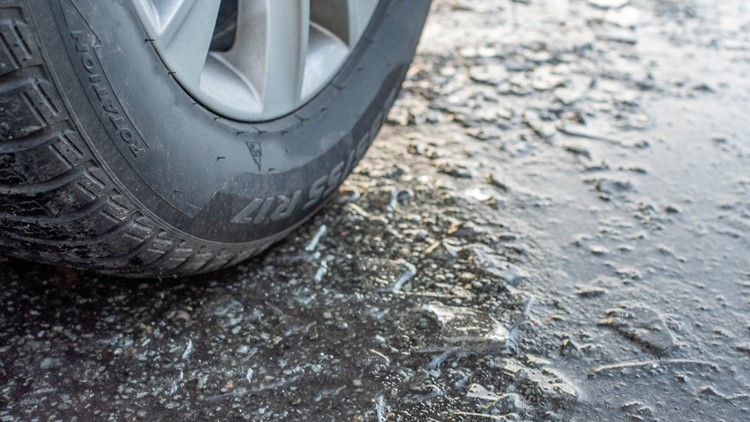
Limited Accumulation Leads to Minor Road Hazards Accumulations are projected to be slushy and short‑lived, forming mainly on side roads, bridges and elevated surfaces during the early‑morning commute [1]. When precipitation pauses and temperatures dip, brief refreezing can produce slick spots, though widespread lowland impacts are not anticipated [2]. Overall, the event should pose only localized travel inconveniences, with most areas warming above freezing by mid‑morning Wednesday [1].
Cold Arctic Air Extends Snow to Mountains, Warmth Returns Later The same Arctic air mass will keep mountain regions receiving 6‑12 inches of snow by week’s end, while lowland snow chances diminish as snow levels rise to roughly 1,500 ft by Saturday [2]. Northern Washington will retain the cold air through early Thursday before a warming trend lifts highs into the low 50s later in the week, ending lowland snow potential [1][2]. This pattern underscores a brief lowland snow episode framed by a longer period of mountain snowfall and subsequent mild weather.
Sources
-
1.
King5: Spotty Lowland Snow Expected Overnight into Wednesday Morning: Forecast details brief snow bursts Tuesday night, First Alert activation, limited lowland impacts, and a warming trend later in the week .
-
2.
King5: Lowland Snow Possible Wednesday as Western Washington Precipitation Increases: Highlights low snow levels near 500 ft, mixed rain‑snow, potential slick roads, mountain snow accumulation of 6‑12 inches, and lingering Arctic air influencing the week’s weather .
Timeline
Dec 17, 2025 – A Blizzard Warning covers elevations above 2,000 ft in the Cascades and Olympic venues, with wind gusts up to 45 mph and snow totals of 10‑36 inches; officials warn travel could be “very difficult to impossible,” close Highway 2 over Stevens Pass and Route 410 to Crystal Mountain, and activate a First Alert (King 5) urging drivers to delay trips and carry emergency kits [16].
Dec 17, 2025 – Strong winds ease across western Washington, a cooler pattern sets in, and snow levels drop, prompting forecasts of 5‑10 inches at Snoqualmie and Stevens passes while an atmospheric river approaches central Oregon, bringing half‑inch rain to lowlands and 1‑2 inches to mountain slopes [15].
Dec 19, 2025 – Warm weather and low snowpack cripple Western ski resorts, with Lake Tahoe lifts operating at minimal capacity, Utah’s Midway Ice Castles postponed indefinitely, and Oregon’s Deschutes Basin recording its slowest snow start since 1981; scientists warn the thin snowpack threatens regional water supplies and fire risk [14].
Dec 19, 2025 – The western U.S. experiences a snow drought that forces Utah backcountry snowmobiling tours to cancel, registers record‑warm Decembers in Arizona, and raises Colorado River water‑risk warnings as spring runoff threatens to fall short; officials note that weak snowpacks could complicate preparations for the 2034 Winter Olympics [1].
Dec 19, 2025 – The National Weather Service issues winter‑storm warnings for Washington, Oregon, Idaho, Montana and Wyoming, forecasting up to three feet of snow, strong winds, and blowing snow through Saturday, with specific warnings for Cascades passes such as Snoqualmie and Stevens [3].
Dec 20, 2025 – Heavy mountain snow returns to the Cascades ahead of Christmas, delivering 18 inches at Stevens Pass and 10 inches at Snoqualmie Pass, while forecasters expect cumulative totals of 1 foot at lower passes and 2‑3 feet at Mount Baker by early Tuesday, prompting travel advisories to avoid Sunday night driving [13].
Dec 27, 2025 – Light snow lingers in western Washington’s convergence zone, dropping up to 2 inches in Snohomish and King counties and 10‑14 inches on mountain passes, after which a dry ridge holds through New Year’s Eve before a new system approaches late Wednesday or Thursday with modest warming [11].
Dec 27, 2025 – A Winter Weather Advisory warns that snow levels will fall to about 2,500 feet on Friday, bringing 6‑12 inches of snow across the Cascades and a rain‑snow mix in lowlands, and urges travelers to check road conditions, carry emergency kits, and avoid mountain passes on Saturday [12].
Jan 5, 2026 – The National Weather Service issues a Winter Storm Warning for the Cascade Range, projecting 2‑4 feet of snow from Tuesday to Thursday, wind gusts of 30‑40 mph in lowlands, and “considerable” avalanche danger above 5,500 feet, while advising motorists to carry flashlights, food, and water [10].
Jan 6, 2026 – Winter‑storm warnings spread to Washington, Oregon, Alaska, Idaho and Montana, with up to 35 inches of snow in higher terrain, snowfall rates near one inch per hour, and travel cautioned as “very difficult to impossible,” prompting the NWS to recommend delaying travel and packing emergency supplies [2].
Jan 8, 2026 – Snow levels in western Washington plunge to about 500 feet overnight, creating a brief rain‑snow mix that could reach sea level by Thursday morning, while the Cascades continue to receive 2‑4 feet of snow under an active Winter Storm Warning, raising avalanche and low‑visibility hazards [9].
Jan 9, 2026 – A snow drought grips the western United States, with Utah’s backcountry snowmobiling tours canceling, record‑warm Decembers in Arizona, and Colorado River water‑risk warnings as spring runoff threatens to fall short; officials note that weak snowpacks could complicate preparations for the 2034 Winter Olympics [1].
Jan 29, 2026 – Despite recent inches of snowfall at key passes (2‑4 inches at Stevens, 1‑2 inches at Snoqualmie), the Cascade Mountains’ overall snowpack remains far below normal, Oregon’s statewide snowpack sits at the second‑lowest level since 1981, and deficits in central and southern Cascades raise concerns for spring streamflow and water resources [8].
Feb 4, 2026 – Early‑February conditions at Snoqualmie Pass feel “like spring,” with slushy surfaces, exposed rocks, and snowpack at under 50 % of normal; Mount Hood Skibowl halts operations indefinitely, and scientists label the situation the worst snow drought on record, warning of tighter water supplies and an extended wildfire season [7].
Feb 17, 2026 – Forecasts call for lowland snow in western Washington on Wednesday as snow levels drop to 500‑1,000 feet, a rain‑snow mix threatens the Kitsap Peninsula and coastal foothills, and mountains are expected to add 6‑12 inches of snow by week’s end before snow levels rise to about 1,500 feet on Saturday, reducing lowland snow chances [6].
Feb 18, 2026 – KING 5 issues a First Alert at 9 p.m. for spotty lowland snow expected Tuesday night into Wednesday morning across Snohomish, King and Pierce counties, with brief mixed showers turning to snow at elevations near 500 feet, minimal accumulation on roads, and a warming trend later in the week that should lift highs to the low 50s [5].
Dive deeper (4 sub-stories)
-
Spotty Lowland Snow Forecast for Tuesday Night Into Early Wednesday Across Western Washington
(5 articles)
-
King5 (Seattle, WA): Spring‑like Ski Conditions Hit Snoqualmie Pass as Snowpack Plummets
-
Cascade Snowpack Remains Deeply Below Normal After Late‑Season Snowfall
(7 articles)
-
Western U.S. Snow Drought Deepens, Threatening Tourism, Water Supplies, 2034 Olympics
(3 articles)
All related articles (16 articles)
-
King5 (Seattle, WA): Spotty Lowland Snow Expected Overnight into Wednesday Morning
-
King5 (Seattle, WA): Lowland Snow Possible Wednesday as Western Washington Precipitation Increases
-
King5 (Seattle, WA): Spring‑like Ski Conditions Hit Snoqualmie Pass as Snowpack Plummets
-
King5 (Seattle, WA): Cascade Mountains Snowpack Lags Behind Recent Snowfall
-
CNN: The western US is in a snow drought, raising fears for summer water supplies
-
King5 (Seattle, WA): Snow levels fall overnight across western Washington, raising chance of lowland wet snow and slick roads
-
King5 (Seattle, WA): National Weather Service issues Winter Storm Warning as heavy snow and high winds head for the Cascades
-
Newsweek: NWS issues winter-storm warnings for five states as up to 35 inches of snow and high winds are forecast
-
King5 (Seattle, WA): Western Washington sees light snow, then dry stretch with freezing nights ahead
-
King5 (Seattle, WA): Snow could complicate post-Christmas mountain pass travel in Washington
-
King5 (Seattle, WA): Heavy mountain snow continues toward Christmas across Cascades, with up to 2–3 feet possible at some passes
-
King5 (Seattle, WA): Warm weather and low snowpack disrupt Western ski resorts
-
AP: Warm weather and low snowpack slow Western ski resorts
-
Newsweek: Winter storm warnings issued for five states with up to three feet of snow through Saturday
-
King5 (Seattle, WA): Blustery weather eases in western Washington
-
King5 (Seattle, WA): Blizzard Warning issued for Olympics, Cascades
External resources (18 links)
- https://forecast.weather.gov/wwamap/wwatxtget.php?cwa=usa&wwa=Winter%20Storm%20Warning (cited 6 times)
- https://nwcc-apps.sc.egov.usda.gov/imap/#version=2&elements=&networks=!&states=!&basins=!&hucs=&minElevation=&maxElevation=&elementSelectType=any&activeOnly=true&activeForecastPointsOnly=true&hucLabels=false&hucIdLabels=false&hucParameterLabels=true&stationLabels=&overlays=&hucOverlays=state&basinOpacity=100&basinNoDataOpacity=100&basemapOpacity=100&maskOpacity=0&mode=data&openSections=dataElement,parameter,date,basin,options,elements,location,networks,baseMaps,overlays,labels&controlsOpen=true&popup=&popupMulti=&popupBasin=&base=esriWgc&displayType=basin&basinType=6&dataElement=SNWD&depth=-8¶meter=PCTPORMED&frequency=MONTHLY&duration=I&customDuration=&dayPart=E&monthPart=E&forecastPubDay=1&forecastExceedance=50&useMixedPast=true&seqColor=2&divColor=7&scaleType=D&scaleMin=&scaleMax=&referencePeriodType=POR&referenceBegin=1991&referenceEnd=2020&minimumYears=20&hucAssociations=true&relativeDate=-1&lat=41.305&lon=-112.429&zoom=5.5 (cited 2 times)
- https://wsdot.com/travel/real-time/mountainpasses/Blewett (cited 2 times)
- https://wsdot.com/travel/real-time/mountainpasses/Cayuse (cited 2 times)
- https://wsdot.com/travel/real-time/mountainpasses/Chinook (cited 2 times)
- https://wsdot.com/travel/real-time/mountainpasses/Crystal-to-Greenwater (cited 2 times)
- https://wsdot.com/travel/real-time/mountainpasses/Mt.-Baker (cited 2 times)
- https://wsdot.com/travel/real-time/mountainpasses/North-Cascade-Hwy (cited 2 times)
- https://wsdot.com/travel/real-time/mountainpasses/Snoqualmie (cited 2 times)
- https://wsdot.com/travel/real-time/mountainpasses/Stevens (cited 2 times)
- https://wsdot.com/travel/real-time/mountainpasses/White (cited 2 times)
- https://forecast.weather.gov/showsigwx.php?warnzone=WAZ310&warncounty=WAC073&firewxzone=WAZ656&local_place1=4%2520Miles%2520NE%2520Bellingham%2520International%2520Airport%2520WA&product1=Wind+Advisory&lat=48.8243&lon=-122.4718 (cited 1 times)
- https://forecast.weather.gov/wwamap/wwatxtget.php?cwa=SEW&wwa=winter%2520storm%2520warning (cited 1 times)
- https://forecast.weather.gov/wwamap/wwatxtget.php?cwa=SEW&wwa=winter%2520weather%2520advisory (cited 1 times)
- https://nwcc-apps.sc.egov.usda.gov/imap/#version=169&elements=&networks=!MSNT&states=!&basins=!&hucs=&minElevation=&maxElevation=&elementSelectType=any&activeOnly=true&activeForecastPointsOnly=false&hucLabels=true&hucIdLabels=false&hucParameterLabels=true&stationLabels=&overlays=&hucOverlays=state&basinOpacity=75&basinNoDataOpacity=0&basemapOpacity=100&maskOpacity=100&mode=data&openSections=dataElement,parameter,date,basin,options,elements,location,networks,baseMaps,overlays,labels&controlsOpen=true&popup=&popupMulti=&popupBasin=&base=esriWsr&displayType=basin&basinType=wa_8&dataElement=WTEQ&depth=-8¶meter=PCTMED&frequency=DAILY&duration=I&customDuration=&dayPart=E&monthPart=B&forecastPubDay=1&forecastExceedance=50&useMixedPast=true&seqColor=1&divColor=7&scaleType=D&scaleMin=&scaleMax=&referencePeriodType=fixed&referenceBegin=1991&referenceEnd=2020&minimumYears=20&hucAssociations=true&relativeDate=-1&lat=48.124&lon=-120.914&zoom=6.9&autoExport=full,pdf,2,2,L,BL,Washington%2520SNOTEL,49.4893,44.9175,-114.8615,-125.2705 (cited 1 times)
- https://wsdot.wa.gov/travel (cited 1 times)
- https://www.wsdot.com/traffic/passes/ (cited 1 times)
- https://nwac.us/avalanche-forecast/#/all/ (cited 1 times)