Snow Returns Sunday to Central Ohio After Heavy Rain, Flooding, and Fog
Updated (14 articles)
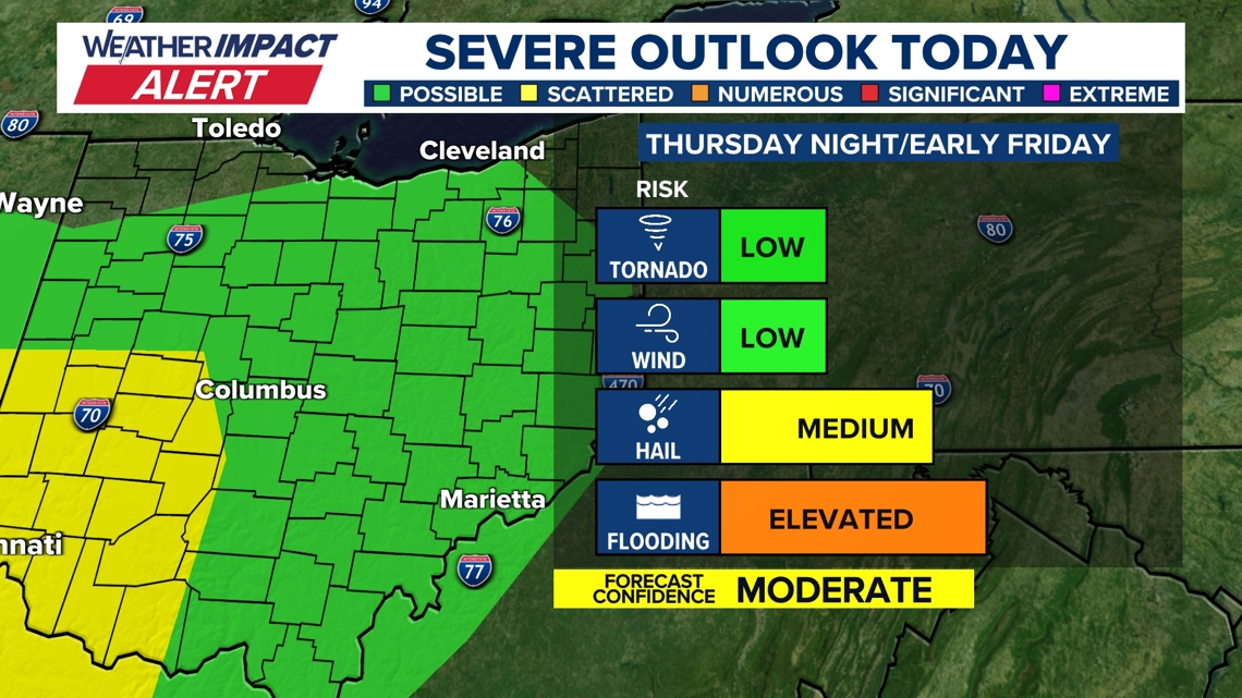
Storm System Enters Central Ohio Thursday Night low‑pressure system moved into the region Thursday night, bringing warm, moist air that fueled strong thunderstorms around 9 p.m. [2][3]. The 10TV Weather Impact Alert Day remained active through the night, warning of marginal level‑1 severe‑weather risk and an isolated tornado that could not be ruled out [2][3]. The system’s warm front ahead of an approaching cold front created moderate wind shear, intensifying the severe‑weather potential across central Ohio [2][3].
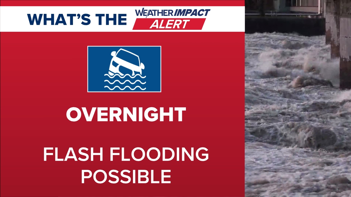
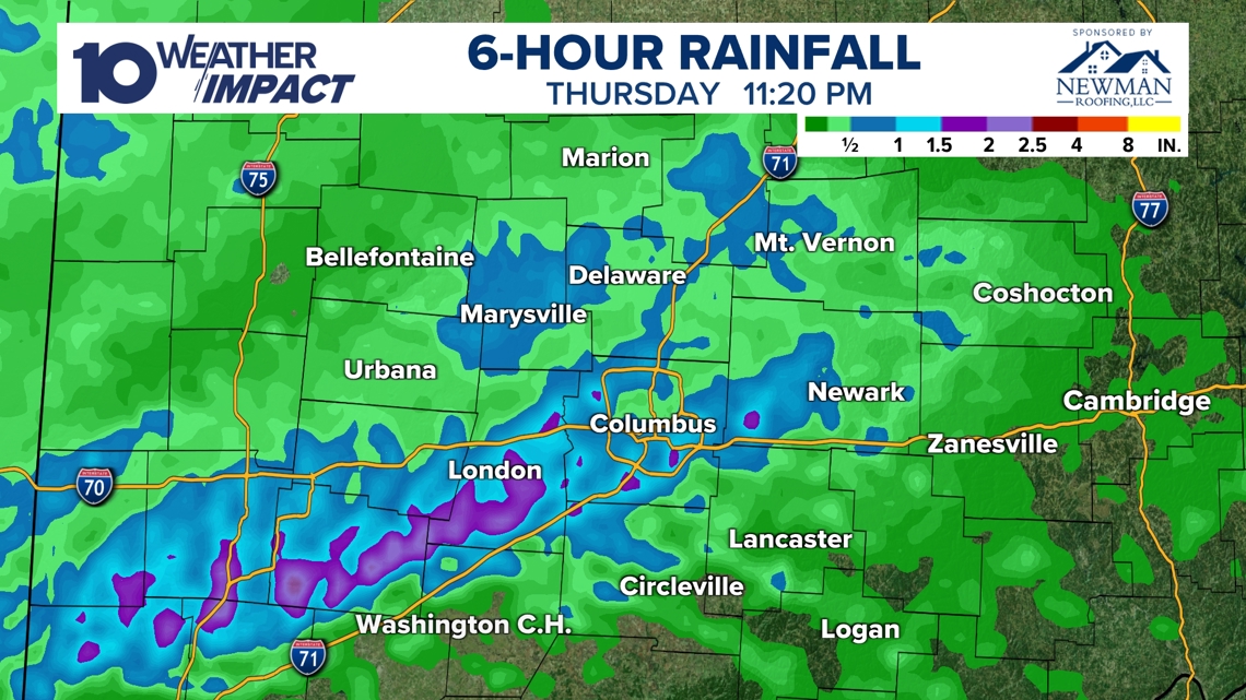
Rainfall Exceeds Two Inches, Flash Flood Threat Radar estimated rainfall totals surpassing two inches in several locations by 11:20 p.m. Thursday, prompting flash‑flood warnings for Fayette and Madison counties through 2 a.m. [2][3]. Early concerns about wind and hail shifted to heavy rain as the primary overnight hazard, with officials urging caution on roads and flood‑prone areas [2][3]. The heavy precipitation contributed to saturated soils that later supported dense fog conditions on Tuesday [4].
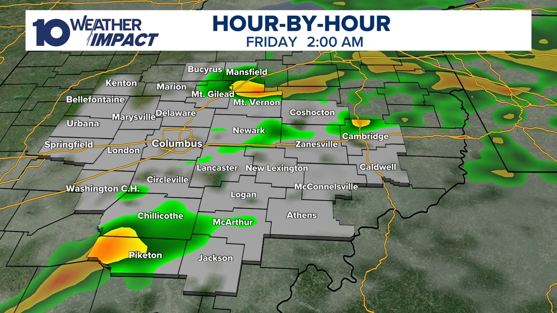
Storms Subside Friday, Snow Showers Possible Sunday Showers and thunderstorms are expected to wane before sunrise Friday, though gusty winds may linger into the day [2][3]. Temperatures will fall, setting the stage for possible snow showers by Sunday as the cold front advances [2][3]. A warm, windy storm later in the week could push daytime highs near 66 °F before a cooling front brings clearer skies and cooler temperatures mid‑week [4].
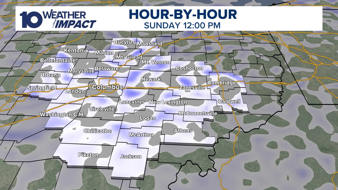
Sunday Snow Brings Light Accumulation and Black‑Ice Hazard On Sunday, a secondary disturbance will deliver scattered snow showers across central Ohio, with the Columbus metro area forecast to receive about one inch, mainly on grass and cold surfaces [1]. Temperatures will rise into the mid‑30s before dropping into the 20s Sunday night, creating black‑ice conditions on Monday‑morning commutes [1]. Warmer weather is projected to return by mid‑next week, with highs climbing toward 50 °F [1].
Sources
-
1.
WBNS: Snow Returns to Central Ohio This Weekend, Light Accumulations Expected – Details the Sunday snow, expected one‑inch accumulation in Columbus, temperature swing to mid‑30s then 20s, and black‑ice risk, noting a brief cold snap ending mid‑week .
-
2.
WBNS: Strong Storm System Brings Severe Weather and Flood Risk to Central Ohio – Highlights Thursday night storm arrival, severe‑weather alerts, shift from wind/hail to heavy rain, flash‑flood concerns in Fayette and Madison counties, and rainfall exceeding two inches .
-
3.
WBNS: Strong Storm System Moves Through Central Ohio Thursday Night – Mirrors the previous report with emphasis on the atmospheric setup, marginal severe‑weather risk, isolated tornado possibility, and forecast of snow showers by Sunday .
-
4.
WBNS: Dense Fog Advisory Triggers Weather Impact Alert for Central Ohio Tuesday – Describes Tuesday’s dense fog advisory, reduced visibility, wet road conditions from prior rain, and upcoming warm storm followed by a cooling front later in the week .
Timeline
Dec 5, 2025 – Ohio records unprecedented wind chills, with temperatures in the single digits and wind‑chill values “lower than the actual air temperature,” prompting Cold Weather Advisories; forecasters expect a gradual warm‑up into the 20s‑30s by afternoon and a wintry front on Sunday that could bring rain and snow [14].
Dec 9, 2025 – A 10TV Weather Impact Alert Day warns of a rain‑snow mix and gusts up to 40 mph affecting Wednesday commuters; snow accumulations remain minimal because temperatures hover near freezing, while a weaker system is expected Friday‑Saturday [13].
Dec 12, 2025 – A heavy snow event drops up to 9 inches in central Ohio on Saturday, accompanied by 25‑mph winds and “wind chills near or below zero”; several counties declare snow emergencies and the National Weather Service issues Cold Weather Advisories [12].
Dec 27, 2025 – A developing storm system moves into central Ohio late Sunday, bringing rain and thunderstorms with a Level 1 severe‑weather risk; a rapid temperature plunge of about 40 °F by Monday triggers flash‑freeze concerns for morning commuters [11].
Dec 28, 2025 – A strong low‑pressure system drives statewide wind gusts of 40‑50 mph on Monday, prompting Wind Advisories, power‑outage warnings, and a sharp temperature drop into the low 20s by early Tuesday [10].
Dec 29, 2025 – Snow begins after 4 p.m., delivering 1‑3 inches of accumulation across central and southern Ohio and “winds in the teens” that produce wind chills in the teens; the alert targets OSU game travel and New Year’s Eve plans [9].
Jan 1, 2026 – A Weather Impact Alert Day warns that up to 2 inches of snow may fall through early night, with “moderate bursts” and localized higher totals; the alert coordinates travel for the OSU game and New Year’s Eve celebrations while temperatures stay in the 20s [8].
Jan 11, 2026 – A cold northwest flow brings snow showers overnight into Sunday, producing “dusting to up to a half inch” and wind‑chill values in the 10s‑20s; sunshine returns Monday and Tuesday with highs in the 40s [7].
Jan 21, 2026 – An arctic blast triggers a Winter Storm Watch for six southern counties, forecasting subzero wind chills from Friday night through Monday morning and “possible snow” with the heaviest snow remaining south of the viewing area [6].
Feb 2, 2026 – Snow returns Friday, delivering 1‑3 inches across central Ohio and “bitter cold wind chills” that persist Saturday; a brief warm‑up on Sunday adds another 1‑2 inch snow band, followed by gradual warming into the 30s‑40s early next week [5].
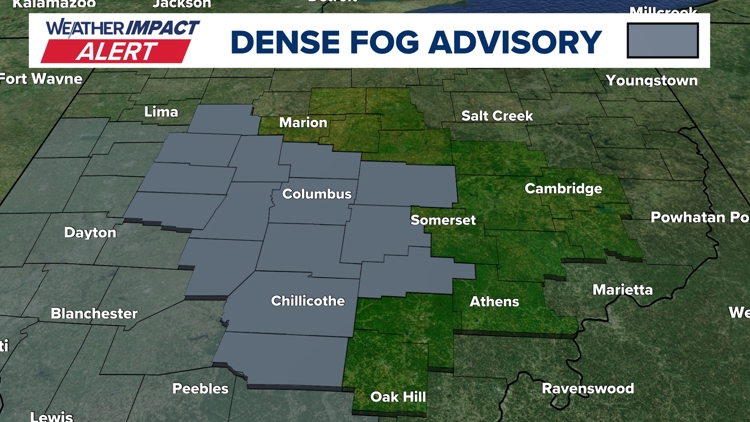
Feb 17, 2026 – Dense fog returns Tuesday, prompting a Weather Impact Alert as visibility drops to a quarter‑mile; forecasters attribute the fog to “cold, moisture‑laden soil from snowmelt meeting warmer air,” and note an upcoming warm storm that could bring near‑record 66 °F heat later in the week [4].
Feb 19‑20, 2026 – A strong storm system moves into central Ohio Thursday night, issuing a 10TV Weather Impact Alert Day; “rainfall totals exceeded 2 inches in several areas by 11:20 p.m.” and the threat shifts from wind/hail to heavy rain and flash‑flooding, with storms waning by sunrise Friday [2].
Feb 20‑21, 2026 – Snow returns over the weekend, with “about an inch in Columbus” and occasional snow squalls that create brief heavy bursts and slippery roads; temperatures rise to the mid‑30s then fall into the 20s, raising black‑ice risk, and warmer weather returns by mid‑week with highs near 50 °F [1].
Dive deeper (11 sub-stories)
-
WBNS (Columbus, OH): Snow Returns to Central Ohio This Weekend, Light Accumulations Expected
-
Central Ohio Faces Heavy Rain and Flash Flood Threat Thursday Night
(2 articles)
-
WBNS (Columbus, OH): Dense Fog Advisory Triggers Weather Impact Alert for Central Ohio Tuesday
-
Snow Returns to Central Ohio Friday, Cold Lingers as Forecast Predicts Gradual Warm‑Up
(2 articles)
-
WBNS (Columbus, OH): Central Ohio braces for weekend snow and subzero wind chills as arctic blast returns
-
WBNS (Columbus, OH): Snow showers expected in central Ohio overnight into Sunday as cold air moves in
-
Central Ohio Braces for Up to Two Inches of Snow as Weather Impact Alert Day Begins
(2 articles)
-
WBNS (Columbus, OH): Central Ohio braces for 40-50 mph wind gusts Monday as a strong low pressure system moves through
-
WBNS (Columbus, OH): Storm system may bring thunderstorms to central Ohio overnight
-
WBNS (Columbus, OH): Rain, snow and wind impacting Wednesday morning commute in central Ohio
-
WBNS (Columbus, OH): Ohio Experiences Record Low Wind Chills on Friday Morning
All related articles (14 articles)
-
WBNS (Columbus, OH): Snow Returns to Central Ohio This Weekend, Light Accumulations Expected
-
WBNS (Columbus, OH): Strong Storm System Brings Severe Weather and Flood Risk to Central Ohio
-
WBNS (Columbus, OH): Strong Storm System Moves Through Central Ohio Thursday Night
-
WBNS (Columbus, OH): Dense Fog Advisory Triggers Weather Impact Alert for Central Ohio Tuesday
-
WBNS (Columbus, OH): Snow Returns to Central Ohio as Bitter Cold Lingers, Forecast Calls for Gradual Warm‑up
-
WBNS (Columbus, OH): Central Ohio braces for weekend snow and subzero wind chills as arctic blast returns
-
WBNS (Columbus, OH): Snow showers expected in central Ohio overnight into Sunday as cold air moves in
-
WBNS (Columbus, OH): Central Ohio braces for up to 2 inches of snow as Weather Impact Alert Day is issued
-
WBNS (Columbus, OH): Snow expected this evening across central and southern Ohio with 1-3 inches of accumulation
-
WBNS (Columbus, OH): Central Ohio braces for 40-50 mph wind gusts Monday as a strong low pressure system moves through
-
WBNS (Columbus, OH): Storm system may bring thunderstorms to central Ohio overnight
-
WBNS (Columbus, OH): Sub-zero wind chills Sunday & Monday after heavy snow Saturday
-
WBNS (Columbus, OH): Rain, snow and wind impacting Wednesday morning commute in central Ohio
-
WBNS (Columbus, OH): Ohio Experiences Record Low Wind Chills on Friday Morning
External resources (9 links)
- http://instagram.com/aaronwhitetv/ (cited 2 times)
- https://www.facebook.com/AaronWhiteTV (cited 2 times)
- https://www.facebook.com/ChrisTomer (cited 2 times)
- https://www.facebook.com/GarofaloWX (cited 2 times)
- https://www.facebook.com/mikebehrenswx (cited 2 times)
- http://facebook.com/AaronWhiteTV/ (cited 1 times)
- http://x.com/AaronWhiteTV (cited 1 times)
- http://x.com/aaronwhitetv (cited 1 times)
- https://www.facebook.com/AaronWhiteTV/ (cited 1 times)